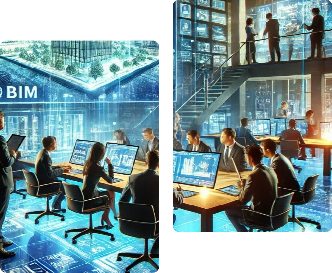
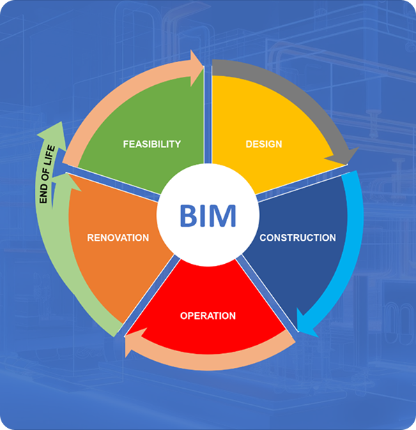
We are a group of highly skilled and versatile engineers that can provide specialized BIM modeling service, Depending on the necessary BIM output we can create, our BIM-related models by using advanced Drones for Surveysing, The BIM division further provides the deliverable data in the form of 3D point cloud, Digital surface models (DSM) Digital terrain model (DTM), Orthmosaic Mappings, Contour generation for further designing procedures which are precisely fitted with fabrication level features as required by the client. Building Information Modeling (BIM) is an integral part of Creative Engineering Consultants comprehensive approach to providing innovative solutions in the field of civil engineering infrastructure projects, With our expertise in data acquisition and processing vide are at the forefront of utilizing cutting-edge technologies to enhance the accuracy, efficiency and effectiveness of our feasibility studies and detailed engineering Designs.
Drone Surveys
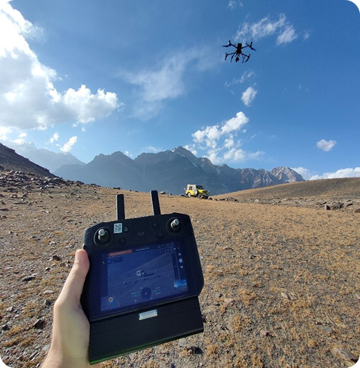
Our proficiency in drop e Surveysing Enables us to capture detailed and up-to-date data with high precision. By deploying unmanned aerial vehicles equipped with advanced sensors, we acquire aerial imagery, LiDAR data and point clouds. These datasets provide us with crucial information for site analysis, volumetric calculations, and 3D modeling. We employ state-of-the-art software for data processing and integration into our BIM workflows. The performance and type of drone, the quality of its Components, the camera Resolution, the Height at Which the drone Flies, the vegetation, and the method and technology used to geolocate the aerial images can heavily influence the accuracy of drone Surveys mapping the point, it is possible to reach an absolute accuracy down to cm (0.4 in) and 0.7 cm/px
Satellite imagery
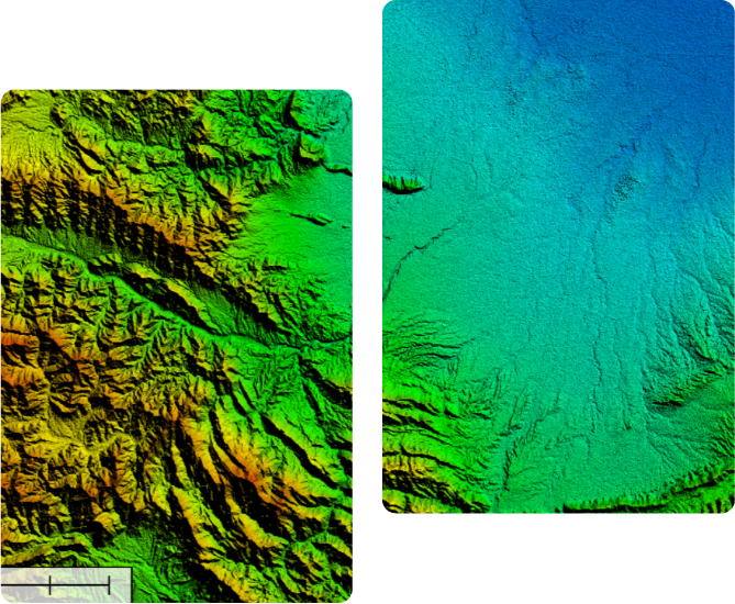
We leverage satellite imagery to gather geospatial data, including topographic information, land cover classifications and terrain analysis. by utilizing advanced image processing techniques, we extract valuable insights and incorporate them into our BIM workflows. This enables us to accurately visualize site conditions, identify potential challenges, and Optimize our feasibility studies.
Services
DGPS based Surveyss
Drone Surveyss
Laser Scanners
3D Scan to BIM
BIM Modeling
Project Scheduling
Clash Detection & Resolution
Walkthroughs & Virtual Reality
Detailed Drawings
Hydrological Assessments
Flood Analysis
Through our expertise in data acquisition, processing, and detailed designing, BIM Division has proved itself to deliver precise and reliable solutions for delivering different projects. By leveraging the power of Building Information Modeling (BIM) and advanced technologies, we ensure that our clients receive the highest quality feasibility studies and detailed engineering designs, setting the stage for successful project implementation.